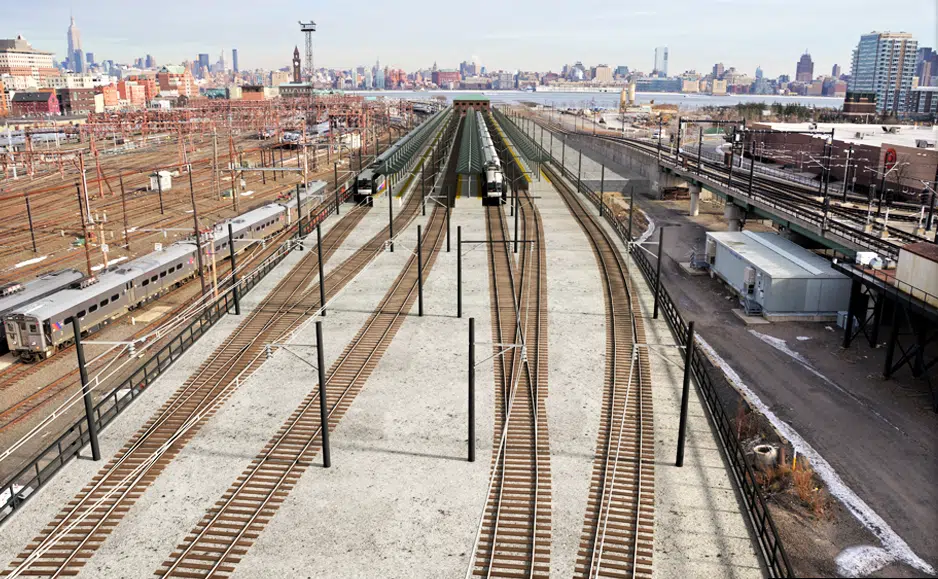
As one of NJ Transit’s major Sandy-Resilience projects, Long Slip is a former barge canal adjacent to Hoboken Terminal Yard and the nearby Hoboken Terminal and its associated Light Rail and ferry services. The Port Authority of New York & New Jersey’s (PANYNJ) PATH twin tunnels cross underneath Long Slip Canal near its midpoint and extend north to the PATH Hoboken Terminal. The canal served as a conduit for flood water during Superstorm Sandy.
The canal served as a conduit for flood water during Superstorm Sandy. The canal will be filled to an elevation above the FEMA base flood elevation for the construction of six new tracks to serve three high-level ADA-accessible boarding platforms, which will allow the rapid recovery of commuter rail services while the main terminal and yard infrastructure are being restored following a storm.
The project involves the construction of a sewer overflow extension, placement of fill over the entire canal and subsequent construction of the new tracks and platforms following a temporary surcharge program for ground improvement.
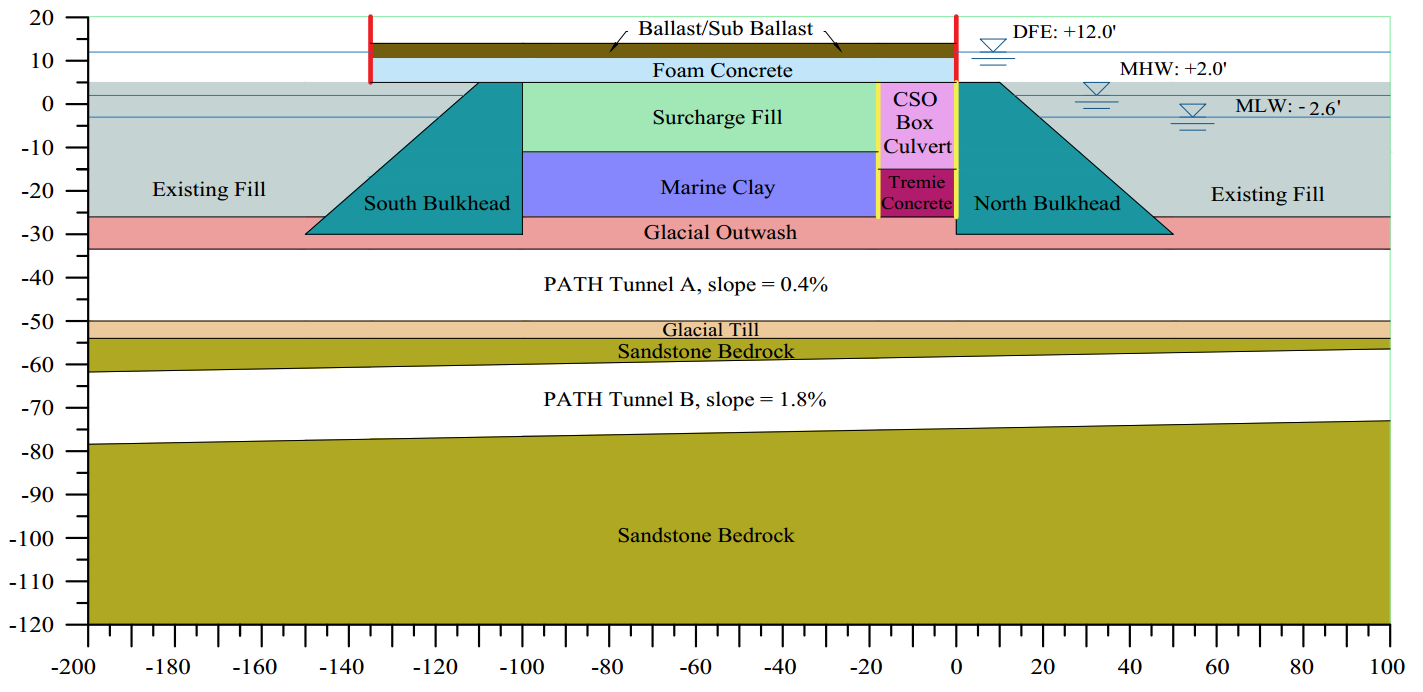
An extension to the existing Jersey City Combined Sewer Overflow (CSO) will be constructed along the northern bulkhead of the canal. After completion of CSO extension, the canal will be filled to El. +5 ft. To minimize post-filling settlement, wick drain will be installed to the bottom of organic marine clay and temporary surcharge fill will then be placed to El. +16 ft. Once the clay is sufficiently consolidated the surcharge fill will be removed to El. +5 ft. Foam concrete will be placed to bring the site grade to El. 10.5 ft. Retaining walls will then be constructed to contain sub ballast/ballast placed to El. 14.5 ft, well above the design flood level. Railroad tracks, platform structures and crew quarters will be constructed on the filled and stabilized site.
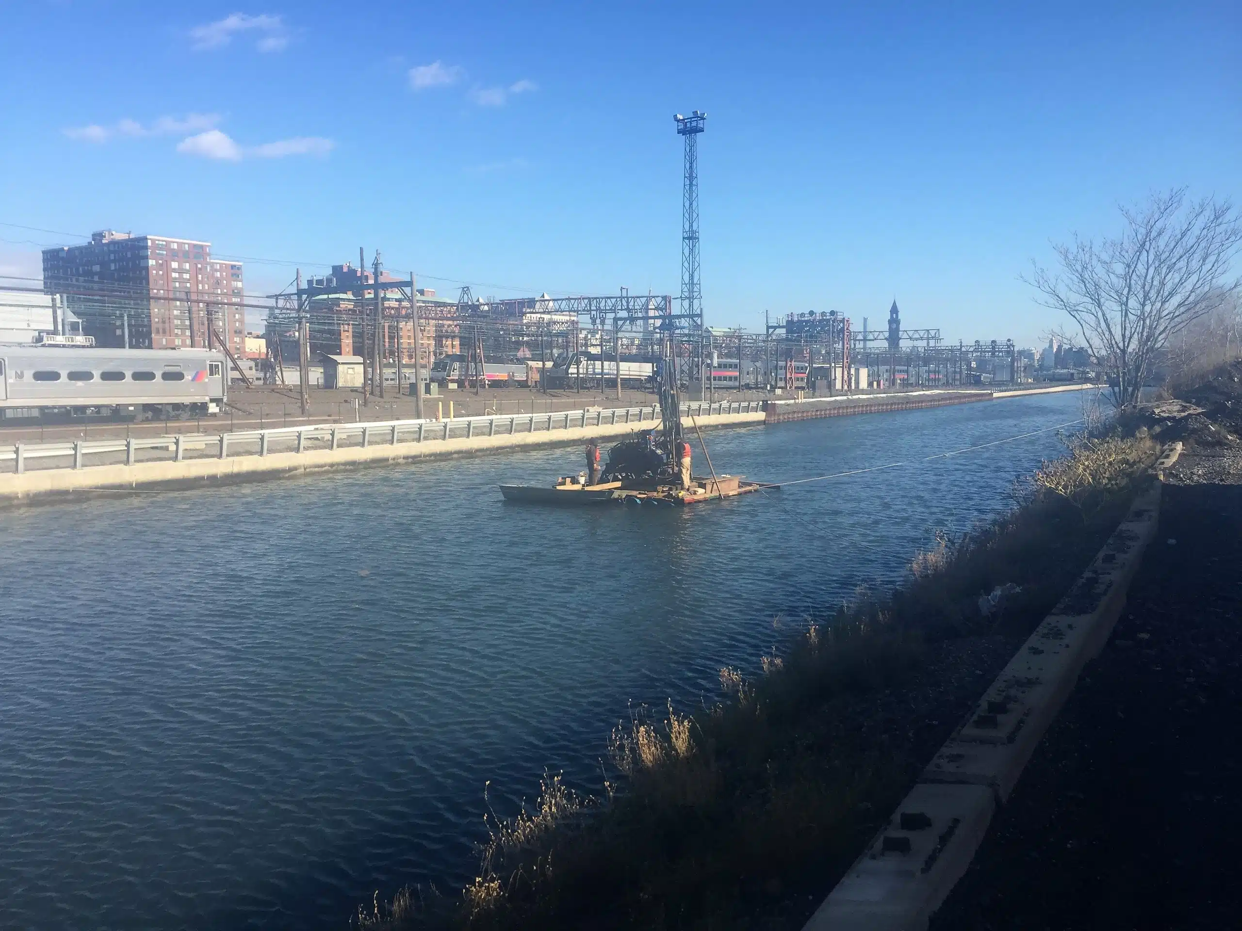
The final geotechnical investigation program included 12 water borings and 6 land borings among other borings previously drilled for preliminary studies. Test pits were excavated to explore foundation remnants of the former Gantry structure south of the canal. Engineering studies of the filling operation and logistics, settlement analyses, surcharge design and foundation evaluations were made. In addition, the impact on the underlying PATH twin tunnels from the filling of the canal was studied by means of soil-structure interaction analyses using both PLAXIS 2D and 3D modeling. Phased canal filling activities were simulated to evaluate stress and deformation changes in the tunnel liner and connector bolts.